KLV / SYSTEM BOOT
KELVAR INDUSTRIES

Kelvar Industries

Eyes Everywhere. Safety Guaranteed.

OPTICAL SYSTEMSONLINE
AUTONOMOUS NETWORKCONNECTED
SIGNAL INTEGRITY100%
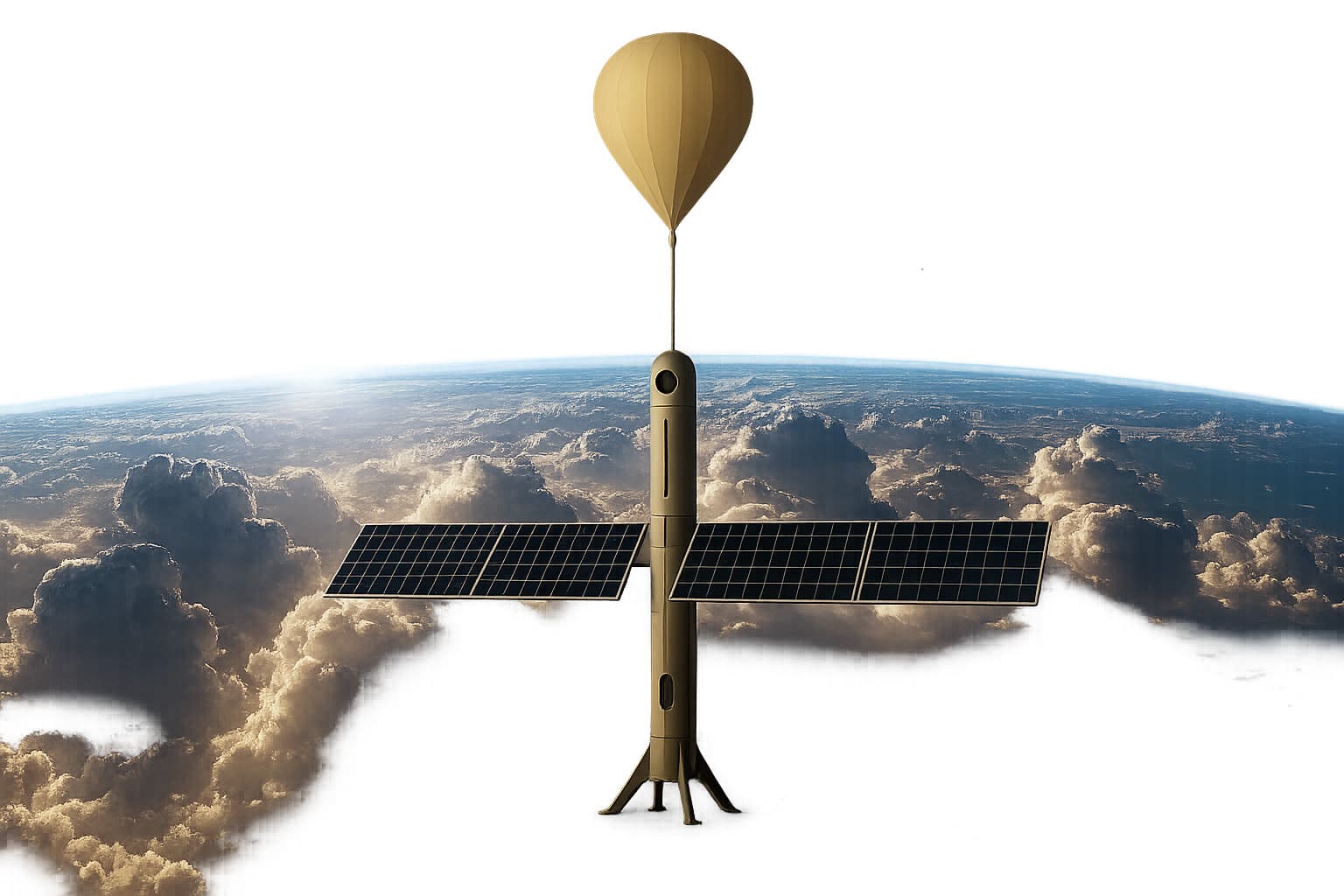
Kelvar stratospheric platform concept above the atmosphere

Advanced Aerospace, Autonomous Systems & Space Technologies

KELVARX

Kelvar Industries' space programme for intelligent aerial, atmospheric, and near-space systems designed to strengthen connectivity, surveillance, environmental intelligence, and sustainable infrastructure.

Atmospheric intelligence for a connected future.

To develop intelligent aerial, atmospheric, and space-based platforms that enhance connectivity, surveillance, environmental intelligence, and sustainable infrastructure across Africa and global markets.

Three systems. One atmospheric intelligence layer.

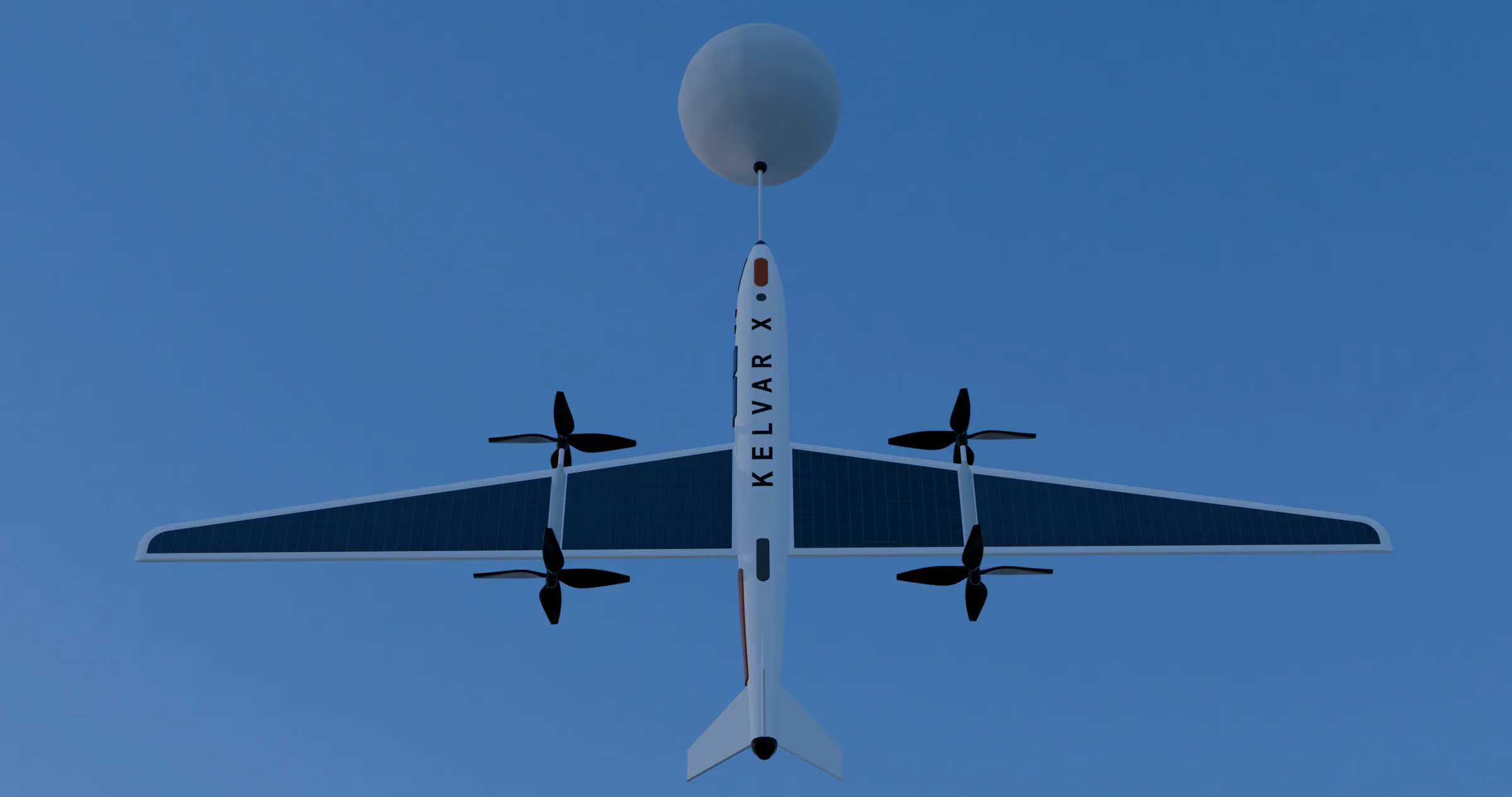
StratoKite balloon-assisted fixed-wing aircraft in flight

Balloon-assisted tail-sitter glider drone

StratoKite

A developing hybrid platform combining helium-assisted lift, a tail-sitter fixed-wing aircraft, radiosonde instrumentation, and intelligent imaging systems.

Payload
  • High-resolution EO camera
  • Thermal camera
  • Radiosonde weather package
  • GPS tracking
  • Environmental sensors
  • AI edge processor
Data
  • Atmospheric pressure
  • Temperature
  • Humidity
  • Wind speed and direction
  • Live aerial imagery
  • Thermal signatures
Missions
  • Agricultural intelligence
  • Border surveillance
  • Environmental monitoring
  • Pipeline inspection
  • Disaster assessment
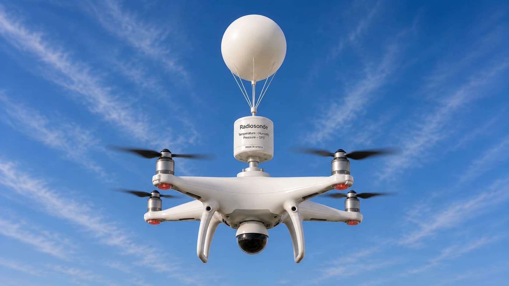
StratoCopter balloon-assisted quadcopter platform concept

Balloon-assisted quadcopter drone

StratoCopter

A developing surveillance and monitoring platform where helium-assisted lift supports endurance while a quadcopter provides positioning and maneuverability.

Payload
  • Daylight zoom camera
  • Thermal camera
  • Radiosonde weather sensors
  • Loudspeaker option
  • Searchlight option
  • AI video analytics
Data
  • Local weather conditions
  • Air-quality indicators
  • Live video feeds
  • Thermal imaging data
  • Wind and atmospheric information
Missions
  • Public safety
  • Event security
  • Infrastructure inspection
  • Emergency response
  • Telecommunications support
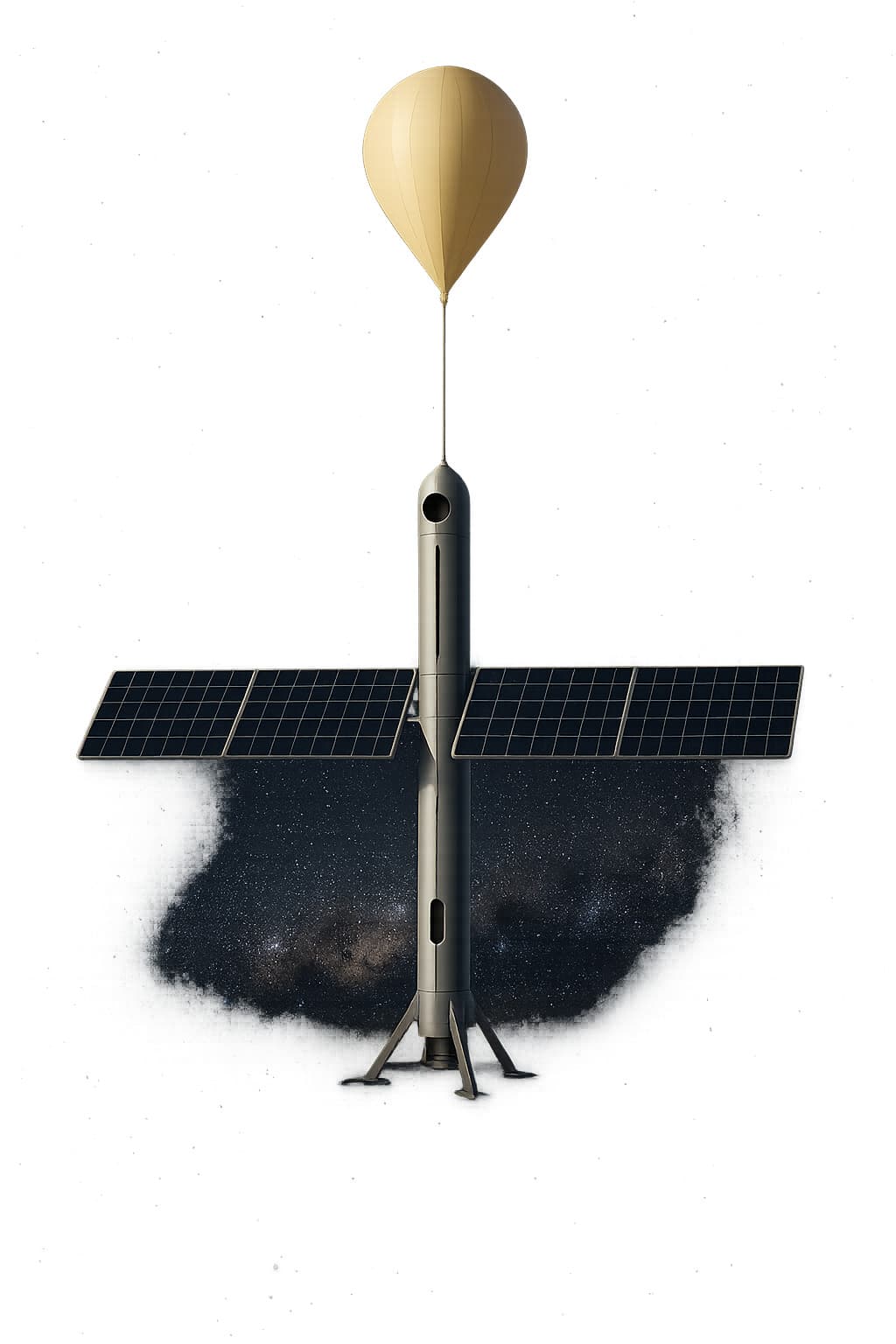
StratoSatellite near-space platform concept

Balloon-assisted near-space satellite drone

StratoSatellite

A developing solar-powered stratospheric concept intended for Earth observation, atmospheric monitoring, and communications relay missions.

Payload
  • Ultra-high-resolution camera
  • Infrared imaging system
  • Radiosonde package
  • Atmospheric sensors
  • Communication relay equipment
  • Solar power management system
Data
  • Stratospheric weather data
  • Atmospheric composition
  • Earth observation imagery
  • Climate data
  • Telecommunications coverage analytics
  • Environmental intelligence
Missions
  • Near-space research
  • Weather forecasting
  • Climate monitoring
  • Rural internet delivery
  • Maritime awareness
  • National security

KAIN

KAIN is the proposed intelligence layer connecting atmospheric measurements and imaging from the Stratos systems into a shared operational picture.

Proposed system architecture · not a live network status display

KELVARX system flowConcept architecture

Platforms

StratoKite

Balloon-assisted tail-sitter glider drone

StratoCopter

Balloon-assisted quadcopter drone

StratoSatellite

Balloon-assisted near-space satellite drone

Signals

Atmospheric Data

Temperature · Humidity · Air pressure

Visual Intelligence

Real-time video · Aerial photography · Thermal imaging

Shared intelligence layer

KELVARX Atmospheric Intelligence Network

KELVAR AI Command

Missions · telemetry · fleet control

Operational outcomes

Environmental and climate intelligence · Agriculture and land planning · Public safety and disaster response

Atmospheric Data

  • Temperature
  • Humidity
  • Air pressure
  • Altitude
  • Wind profiles
  • Air density

Visual Intelligence

  • Real-time video
  • Aerial photography
  • Thermal imaging
  • Environmental change detection
  • AI object recognition

Applications

  • Weather forecasting
  • Climate research
  • Flood prediction
  • Agricultural planning
  • Wildfire detection
  • Disaster management

KELVAR AI Command

A developing command environment intended to manage KELVARX assets, telemetry, missions, and intelligence workflows from one operational layer.

Command surface conceptIllustrative

Atmospheric field / no live data

Fleet overview

Telemetry

Mission state

Intelligence events

Real-time weather mapping

Radiosonde telemetry monitoring

AI video analytics

Fleet control

Mission planning

Predictive maintenance

Digital twin simulation

Data archive and analytics

From atmospheric data to operational outcomes.

Environmental and climate intelligence

Build richer atmospheric datasets for forecasting and research.

StratoKite · StratoSatellite / KAIN

Agriculture and land planning

Support planning with aerial imagery and local weather intelligence.

StratoKite / Both

Public safety and disaster response

Provide timely visual and environmental awareness during incidents.

StratoCopter · StratoKite / KELVAR AI Command

Border, maritime, and infrastructure awareness

Extend observation across remote assets and strategic corridors.

StratoKite · StratoSatellite / Both

Telecommunications and rural connectivity

Explore high-altitude relay coverage for underserved regions.

StratoSatellite · StratoCopter / KELVAR AI Command

Near-space research

Enable recoverable atmospheric and Earth-observation missions.

StratoSatellite / KAIN

KELVARX

Measuring the Atmosphere. Monitoring the Earth. Connecting the Future.